|
|
Welcome to suedamerika24.com
Südamerika24.com
to get so much tips and useful Information about the countries and
cities in South America.In addition to general information about
South America and cities in South America is available on Südamerika24.com
many useful tips to Entry requirements of countries in South America,
attractions in South America, the nightlife in South America, Hotels
and B & Bs South America, news of South America, and much more.
Tourism and
Travel, La Paz, Bolivia holiday, the highest seat of government
playground of the world and millions of Indians, colonial buildings
in incredible mountain scenery, trips to Lake Titicaca and boat
tour to the
Sun Island, we speak of a floating island in the lake, excellent
accommodation in Chopacabana, *****- Hotels and unique service.
Machu Pichu in Peru, multi-day tours local guides to the ancient
Inca ruins in the middle of the Andes,
Visit to Cusco and Lima, where the cultural life of quakes. Trip
to Galapagos Islands, 1,000 km off the coast of Ecuador, unique
Biodiversity and biodiversity, Dawin-finches and Galapagos -
Turtles. The two countries meet between Brazil and Argentina to
the waterfalls of Iguazu, by jeep to Patagonia and the
Ship to the Easter Islands, crickets in the Atacama desert and bathing
in Port of Spain, Trinidad.
|
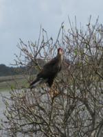
Eagle
in the National Park
|
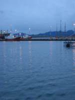
Port in
Argentina
|
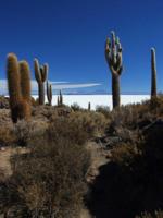
Bolivia
|
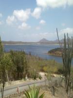
Bonaire
|
South America
is the southern part of the Americas and covers an area of ??17.843
million km ² and a population of nearly 400 million people
the fourth largest continent on earth.
|
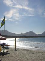
Beach
in Brazil
|
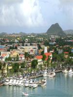
Bay in
Aruba
|
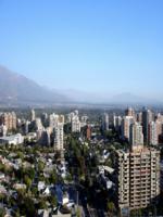
Chile
|
Curacao
|
The South
American continent can be divided into three main regions:
* The Andes mountains than on the west side of the continent
* Three river valleys east of the Andes
* Three highlands east of the Andes
On the west coast to the Andes, the longest overseas mountain range
on earth. The high mountains stretches along the Pacific Ocean about
7,500 km from Venezuela to the southern tip of Patagonia along.
The highest mountain in the Andes, also the highest mountain in
South America and is the highest mountain outside Asia, with 6962
m altitude of Aconcagua. It lies on the border between Argentina
and Chile. The deepest point of South America is on the Valdés
Peninsula, 40 meters below sea level. As the southernmost point
of South America is generally referred to Cape Horn.
The largest current level is the Amazon Basin (Amazonia), an equatorial
rain forest lowlands, which is drained by the Amazon with its 10,000
tributaries. He's from the Andes across the continent to the east-flowing
Amazon with about 6448 km the longest river in South America and
the largest river on earth. North of the Orinoco-level, which is
limited to the Amazon basin to the south through the highlands of
Guiana and north through the Venezuelan coast mountains. Another
current level is in the south of the continent, where the river
system of Río Paraguay and Río Paraná in the
Pantanal in the north to the south is coming in a subtropical flood
plain.
The highlands are the mountains of Guiana, the Brazilian highlands
and the mountains Ostpatagonische. The mountains of Guyana is divided
into the rain forest mountains Südvenezuelas, the Central Highlands
of Guyana and the Eastern Highlands of Guyana, extends between the
current level of the Orinoco and the Amazon with a maximum elevation
of up to 2,800 m. The Brazilian central highlands of South America
dominated central and to the coast of Brazil and the Argentine pampas
in the south. The Ostpatagonische mountains rising in the east of
the Andes at the southern tip of South America.
|
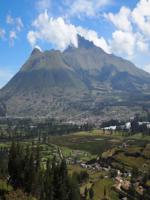
Landscape
in Ecuador
|
Falkland
Island
|
French
Guiana
|
Guiana
|
The climate
of South America is very complex. Year-round climatic influences
of the cold Humboldt Current along the west coast of Peru, the intertropical
convergence zone (ITCZ), the formation of tropical cyclones on the
edge of the subtropical high pressure area and the trade winds.
The cold Humboldt ocean current causes a cooling of the ocean surface
off the coast of Peru and northern Chile, which leads to the formation
of coastal deserts. This phenomenon is based on the fact that the
cooled air leads to a constant inversion, thus a stable high pressure
area that no convection, and thus does not allow precipitation.
The implications are vast desert regions on the coasts. The equatorial
tropics situation occurred in the southern winter training of Inner
Tropical convection over the central Amazon region, leading to heavy
precipitation. In summer it is shifting to the south, thus the inner
tropics characterized by year-round rainfall. Also in summer, is
from a continental heat low, which is very rainy. The southern edge
tropics are thus characterized by (southern) summer rainfall. The
tropics are the northern edge of Passat dam in the east (year-round
high rainfall) and by cool sea water at the coast in the north (very
low rainfall) indicated.
Südpassatwinde the lead on the east coast to increased rainfall
in the coastal regions, characterized by the formation in the southern
summer monsoonal easterly winds and rainfall in the southern winter
by back to the coastal regions. The stable high pressure system
on the western edge of South America, combined with the cold air
masses of the southern polar regions leads to the formation of extra-tropical
cyclones off the coast of Western Patagonia. The cyclonic fronts
vary in their position in the austral summer and austral winter.
The shift to the north in the southern winter rainfall leading to
periodic winter in the Deep South of Chile (Chile jungle) and sporadic
winter precipitation in the small southern Chile. In return, the
shift of the cyclonic fronts in the southern summer (affected by
the changed position of the ITCZ) to a pronounced summer drought
across southern Chile, other than Patagonia. The cyclonic fronts
form on the windward side of the Patagonian Andes Mountains heavy
rainfall accumulation, which can be called a hyper-maritime. This
dynamic precipitation on the west side lead to the leeward side
of the Andes of Patagonia is characterized by dryness.
The Andes themselves have a more climatic division in the vertical
dimension. Universally can distinguish five altitude levels: the
Tierra Caliente (Hot Earth, up to 1000 m), Tierra Templada (Temperate
Earth, up to 2000 m), the Tierra Fria (Cold Earth, up to 3500 m,
growing strength and frost line), Tierra Helada (Icy earth, up to
4500 m, snow line) and the Tierra Glacial (glacial soil, to 6000
m, Anökumene).
Furthermore, present in the Andean glaciations. In Peru, the largest
inter-tropical glaciations in the world can be found. In Patagonia
there is a vast inland ice and end up reaching down to sea level
glacier tongue.
An important for Chile's El Niño climate phenomenon, because
even though it from its origin is a purely oceanic phenomenon ago
to be perceived primarily its climatic consequences. The cold-water
streams of South America from crack and it collects water off the
South American coast. As climatic episode raises to be taking the
normal prevailing stable high pressure situation and there is a
reversal of the Walker circulation, with serious effects of heavy
rainfall.
South America
is part of the Neotropical zoogeographical seen region that includes
Central America and West Indies. The South American continent was
isolated during most of the Cenozoic of the other continents. At
that time, were formed unique mammalian forms, some of which today
are characteristic of South America. These include various marsupials,
the armadillos, anteaters and sloths. The New World monkeys and
guinea pigs relatives also arrived very early (from probably from
Africa) and island hopping on the continent and brought forth an
abundance of native species. The rest of today's mammalian fauna
of the Neotropical region is, however, mostly from groups who migrated
in the wake of the great American faunal about 3 million years ago
from North America. Back then walked cloven hoofed animals (deer,
camels, peccaries), Perissodactyla (tapirs) rabbits, carnivores
(cats, dogs, raccoon, bears, small bears), shrews and rodents and
squirrels Neuweltmäuse families from North America to South
America. In addition, the time came, the mammoths and horses to
South America, but disappeared during the Quaternary extinctions
at the end of the Pleistocene again. They disappeared, many other
large animals, such as the giant sloths, glyptodonts, Toxodonten,
Macrauchenia and the saber-toothed cat Smilodon [2]. Was South America
to 12,000 years ago a continent of the Giants, so today is the Central
American tapir is the largest land mammal on the continent. Jaguars
and Spectacled Bears are the largest land predators dar.
|
City in
Colombia
|
Beach
in Paraguay
|
City in
Peru
|
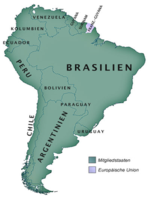
Map south
Amerika
|
On 1 January
2010 lived in South America about 390 million people. The population
of South America is characterized by mixing of peoples, as indigenous
inhabitants were at home there and the ethnic groups who have settled
here later. The latter were mostly European immigrants or slaves
shipped from Africa here. Thus, the predominant share of the Mestizo,
mulatto and the zambos. In Brazil, the Afro-Latin Americans make
as descendants of the slaves shipped from Africa a larger proportion
of the population. Remnants of the indigenous people live almost
exclusively in the Andean highlands and the Amazon. Only in some
countries, the indigenous peoples a substantial proportion of the
population, in Ecuador, Peru and Bolivia
As South America
was divided in 1494 between Spain and Portugal, Portuguese spoken
in Brazil today in its Brazilian version, while almost all other
South American countries, the national language is Spanish. Only
in Suriname is Dutch as official language, spoken and Sranan Tongo
as a lingua franca, in Guyana and Trinidad and Tobago English and
in French Guiana, but this is not an independent state, but a French
Overseas Department, French.
Other European languages ??that are common in South America, English
(some in Argentina), German (in the south of Brazil and Chile, Argentina,
Paraguay and in the German towns of Venezuela) and the Low German
Plautdietsch, Italian (in Brazil, Argentina, Uruguay and Venezuela)
and Welsh (in southern Argentina).
In Bolivia are indigenous languages ??- spoken by more than half
the population - some with Spanish. Quechua and Aymara are spoken
by far the most, followed by the Guaraní spoken in the eastern
lowlands. Since 2009, all indigenous languages ??of Bolivia by the
Constitution are recognized along with Spanish as official languages.
In Peru, Quechua and Aymara languages ??besides Spanish regionally
recognized. The spread in the highlands of Ecuador, Quechua related
Kichwa (or Quichua) is there though not an official language, however,
acknowledged constitutional. Guaraní is an official language
alongside Spanish in Paraguay, where it is used by a bilingual majority.
Colombia recognizes all indigenous languages ??spoken in the country,
as official languages, but these are less than one percent of native
speakers. The most widely spoken indigenous language in Chile is
Mapudungun (Araucanian) of the Mapuche in Southern Chile, but there
are also widespread in northern Chile Aymara and Rapanui on Easter
Island
|
Beach
in South Georgia
|
Beach
in Suriname
|
Beach
in Trinidad
|
Beach
in Uruguay
|
History, Argentina,
Peron and Eva Duarte, known as Evita, German immigrants establish
a well in Buenos Aires, the pre-Columbian time of the Spanish and
Portuguese people forget, argentum = silver, which are hoped the
conquerors there, as opposed to el dorado , the gold country, that
they suspect in the Andes and ultimately destroy it, flows come
from the gold of the Incas to Spain, some vessels are lost, the
locals are enslaved and the Christian faith has arrived in South
America. Suriname, a Dutch Guyana, has a history as a Dutch province
and the only country in South America with this language.
|
|